Watersprite Lake Hike
A gem of a hike in the Squamish area
CANADA
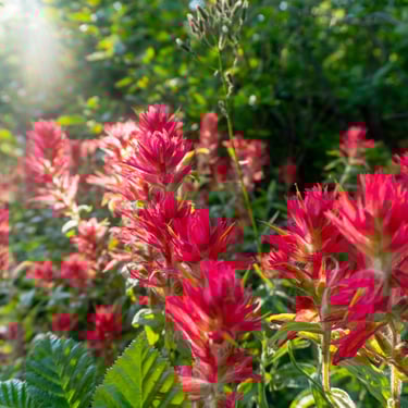
For this hike, a 4 wheel drive vehicle is recommend to get to the trailhead. The hiking trail to the turquoise coloured Watersprite Lake offers some incredible views of the area around the Mamquam River, including mountain peaks in the southern region of Garibaldi Provincial Park, Martin Peak, Dreadnought Peak, and extensive views of the Watersprite Creek Valley.
The scenic trail begins east of Squamish, about 20 km up the Mamquam and Skookum Forestry Service Roads and follows old logging roads overlooking the valley before a final ascent up a boulder field to the lake.
After walking for about 20 - 30 minutes (1.5 km), the trail veers left and onto a section of narrow trail that first descends quickly, before climbing through the forest. Follow the orange aluminum tree markers until you reach a junction at a wide trail which is an old logging road. Note this junction as you will return to here and will need to follow the narrow trail back to the parking lot. Go right on the wide trail and continue hiking along the well defined route as you cross another wooden bridge over Skullhead Creek, this time further.
The trail veers sharply left after about 1.4 km and climbs up a steep, rocky section for about 600-meters before veering right and opening up to a view of the valley below. As you continue along the trail, just beyond the clearing with the viewpoint, the trail crosses a small creek next to a waterfall.
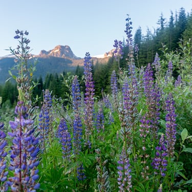
After emerging from the creek bed, follow the trail for another 600-meters until it rounds a corner and arrives on a ridge, known as "The Prow Lookout", that overlooks the entire valley. From here, you can witness one of the most scenic viewpoints in the region, seeing as far down the Mamquam River Valley towards Squamish, across the valley to Columnar Peak and the Garibaldi Provincial Park area, and up towards Spire Peaks, Pyramid Peak, and many more.
The route we took was the trail to Watersprite Lake that was built by the British Columbia Mountaineering Club and completed in September 2016. The old route has been deactivated due to extensive wear and damage to the bog portion of the trail. This route follows deactivated logging road routes along higher ridges, offering many scenic views on the way to the lake. From the parking lot area, pass the metal gate and follow the old gravel road that veers off to the right, heading up a gradual hill. A trail kiosk with maps and information is installed at the top of this hill.
The trail continues through an open gravel section, passing the Skookum Dam below to your left, before narrowing and joining an old logging road. This section of trail climbs gently and passes over a couple of creeks, including the bridge over Skullhead Creek, as you quickly make time along the route.
Continue following the trail along the route to Watersprite Lake for the next 2.3 km as it offers many open views of the surrounding mountains and the Watersprite Creek Valley below. The trail continues climbing gradually until it reaches a rockslide area. As the rockslide slows your pace, follow the markings and flags across the rockslide for about 800-meters until you enter the forest on the far end.
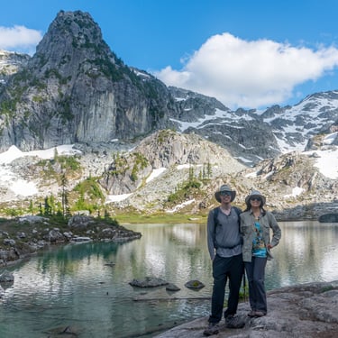
The trail passes through a forested section, crossing Watersprite Creek before exiting the forest and crossing a second boulder field. The very steep ascent up the boulder field is the final section of trail to the lake. Carefully make your way up the rocks, following the trail until it begins to level and Watersprite Lake comes into view. Walk out onto the rocky outcrop for a full view of the scenic area, including the turquoise coloured lake, Martin Peak, and Dreadnought Peak.
There are several locations around the lake to enjoy lunch and the scenery but please ensure to find a location that has minimal impact on the sensitive ecology. A cabin and were built by the BCMC in 2016 and are located on the west side of the lake.
After enjoying time at the lake, begin your hike back by follow the trail back down the rockslide and heading to the right side of the slide to where the trail continues. Cross Watersprite Creek and follow the route through the forest, back across the rockslide and along the open trail with many views. Descend down the rocky section before veering right and following the trail back to the 3-way junction. Make sure to go left at the 3-way junction, following the trail downhill and returning via the first section to the parking lot. Happy exploring!